
The weather in the 1st quarter of 2022 (January, February, March), heating degree days from April 2021 to March 2022. The January weather was dry and warmer than average. It was stormy in February, with impressive peak gusts. March was again extremely sunny and dry.
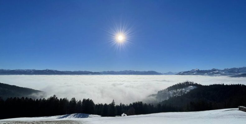
Mild and sunny January with little precipitation
January brought a lot of sun and was correspondingly warm.
The precipitation was below average. On the southern side of the Alps, they were only about a fifth of the long-term average. January started very mildly with highs of around 19 °C on both sides of the Alps.
From January 1st to January 4th, very mild air flowed into our country from the west and south-west. On January 2, the zero degree limit was around 3800 meters, which corresponds to the second highest January value since measurements began in 1954. The mild air brought new January records for the daily maximum temperature at 17 measuring locations throughout Switzerland (eg 19.2 °C in Poschiavo, 18.7 °C Basel Binningen). From January 5th to 10th, polar cold air determined the weather in Switzerland.
On the northern side of the Alps, snow fell several times down to low altitudes. On the south side of the Alps, the cold air brought a lot of sunshine and daily highs of 10 to 12 °C. From the 11th to the 27th of January, winter high pressure weather prevailed over Switzerland. The southern side of the Alps received a lot of sunshine from January 5th. The long sunny period lasted until the end of the month in the south. Very dry in the south: there was little precipitation throughout Switzerland in January.
The southern side of the Alps already received well below average amounts of precipitation last December, so that the months of December and January together only reached 21% of the norm. As a result of the persistent drought, a major forest fire broke out towards the end of the month in Ticino in the Gamborogno region on Lake Maggiore. The low amounts of precipitation since the beginning of winter led to a pronounced lack of snow on the southern side of the Alps in January.
At just 1 cm, Bosco-Gurin (1486 m) registered the lowest mean January snow depth since measurements began in 1961, and in San Bernardino (1639 m) there was only 5 cm of snow on average. From 28th to 30th January the weather on the north side of the Alps was changeable. On January 31, a cold front from the north brought persistent snowfall in the Alps. On the southern side of the Alps it remained mostly sunny with a north foehn wind and on January 30th the daily highs rose to a very mild 18 to 21 °C.
Monthly balance for January 2022
The average January temperature was 0.8 °C above the 1991-2020 norm.
At lower altitudes north of the Alps, it was 0.1 to 0.8 °C above average. Temperatures of 0.5 to 1.5 °C above the long-term average were recorded in mountain locations, and locally also around 2 °C. On the south side of the Alps, January brought widespread temperatures of 2 to 3 °C, in mountainous areas around 3.5 °C above the average. In central Valais, the January temperature remained 1 to almost 3 °C below the norm. The precipitation totals in January were mostly below average. In many areas less than 50% fell, on the southern side of the Alps less than 20% of the norm. In January, the amount of sunshine north of the Alps was 150 to 180%, locally also 190 to almost 200% of the norm. In the Alps it was mostly between 120 and 140%, in Valais locally between 150 and 160% of the long-term average. 135 to 150% of the average was recorded on the southern side of the Alps and up to almost 160% in southern Ticino.
Warm and stormy February
February was very mild with lots of sunshine.
In the lowlands on the north side of the Alps there was no snow and on the south side of the Alps there was very little precipitation. Various storm lows caused strong winds again and again. February started with a two-day stormy north to north-west wind. Under the influence of high pressure, it was mostly sunny throughout Switzerland on 4 and 5 February. It got stormy again on February 6th and 7th. The period from February 8th to 13th was characterized by high pressure and was continuously sunny in some areas. From February 16th, a hurricane low over England brought stormy conditions, first in the mountains, and on February 17th and 18th also at low altitudes. Another storm that moved from Scotland across the North Sea to the Baltic Sea caused turbulent conditions in Switzerland from 20 to 21 February. North of the Alps, the peak gusts often reached 70 to 90 km/h, occasionally over 100 km/h. Peak gusts of between 100 and 150 km/h were often recorded on the Jura heights and in the Alps. Occasionally the values were between 160 and 180 km/h. The first two storm periods (February 1/2 and February 6/7) brought stormy northern foehn with peak gusts of 80 to over 100 km/h at low altitudes on the south side of the Alps. On the other days of the storm (February 17/18 and 20/21), the northern foehn developed at the higher measuring locations Simplon-Dorf and Poschiavo with peak gusts of between 80 and 100 km/h. With the stormy winds, there were heavy fresh snowfalls, especially in the Eastern Alps. The southern side of the Alps received a large amount of fresh snow, especially from 14 to 15 February. From February 26th to 28th it was mostly sunny in the north, in western Switzerland and in the south from February 25th.
Monthly balance for February 2022
The national mean for February was 1.8 °C above the norm.
In the lower areas on the north side of the Alps, it was widely 2.3 to 2.7 °C above the average. In mountain areas, temperatures were mostly 1 to 2 °C, on the southern side of the Alps widespread 2 to 2.5 °C above the long-term average. In February, total precipitation north of the Alps reached 70 to 90% of the norm.
In many places on the Jura mountains and in the Alps, the monthly totals ranged between 120 and 165% of the average. The southern side of the Alps again remained low in precipitation. Regionally, less than 30% of the long-term average fell. Sunshine duration in February reached 130 to 145% of the norm across a wide range north of the Alps. In the Alps it was mostly between 100 and 120% of the average. The southern side of the Alps received 120 to 140% of the long-term average.
Extremely sunny and dry March
March brought a lot of sunshine and extremely little precipitation in Switzerland.
The northern side of the Alps counted 24 sunny days, the southern side 19. There was only widespread precipitation on three days. Sunny high-pressure weather dominated in Switzerland in March.
The days from March 1st to March 10th were mostly sunny. After a four-day break from March 15th to 18th with gloomy conditions across the country, the sunny high-pressure weather returned on March 19th. Until March 28, clouds were rarely visible in the sky. The sunny high-pressure weather blocked the supply of moist sea air.
Larger amounts of precipitation fell in Switzerland on March 15, especially in western and north-western Switzerland and in Valais. From March 15th to 18th, humid and mild Mediterranean air flowed towards Switzerland from the southwest and south. She carried a lot of Sahara dust with her. The cloud-covered sky temporarily turned an intense yellow-brown. March 30th and 31st were the other two days of widespread precipitation. Extremely little precipitation: In the central and eastern parts of the country, it was the month of March with the lowest or second lowest total precipitation since the start of measurements at several measurement locations with more than 100 years of measurement series. Forest fires broke out in the cantons of Bern, Ticino and Valais due to the persistently dry conditions.
Monthly balance for March 2022
On average across the country, the temperature in March was 1.0 °C above normal.
It was 0.5 to 1.4 °C above average in the low-lying areas on the north side of the Alps. In mountain areas, temperatures of 1.1 to 1.8 °C were mostly recorded, locally more than 2 °C above the long-term average. On the south side of the Alps, the March temperature was widely 0.3 to 0.9 °C, locally up to 1.2 °C below the norm. In March, total precipitation in western Switzerland and on the western slopes of the northern Alps reached 20 to 30% of the norm. On the central and eastern northern slopes of the Alps, the monthly totals ranged between 30 and 40% of the average in many places. Less than 10% of the long-term average fell in northern and central Grisons as well as in parts of the southern side of the Alps and Valais. In the other areas there was mostly 10 to 20% of the norm. The big exception was the Basel region: With the two days of precipitation at the end of the month, the monthly totals rose to 60 to 80% of the long-term average. The amount of sunshine in March was regionally well above the norm, especially on the north side of the Alps.
In Zurich, for example, it was the sunniest March since measurements began in 1884, with over 250 hours of sunshine. In most places, the sun shone longer than the long-term average, and in some places it was the sunniest March since measurements began. Swiss map with climate stations
Tables as PDF:
Heating degree days April 2021 to March 2022_heating limit 12°C_room temperature 20°C
Climate data in the first quarter of 2022
Source: MeteoSwiss, climate bulletins 2022